With little information available on the internet and only a basic map that we had found in a hostel in Palenque, Alex and I planned to walk our way through the Biosphere of Montes Azules and the Lancandon jungle. The idea was that it would be cheaper to walk and you would have time to take in the scenery and meet some interesting people along the way. Oh and it would be something challenging, that’s what Alex wanted, to do something challenging.
We set off from Palenque along the main road that goes alongside the Guatemalan border. We asked the collectivo driver to drop us off at the junction that would be the start of our walk. Our first destination would be Bajlum Paakal, an Eco-Touristic Centre approximately 7km from the main road. We wanted to go here as this was the place you needed to get to if you wanted to see La Asuncion, a beautiful waterfall with very little info on the world wide web. Knowing that you could camp there, it was going to be a cheap start to our adventure.
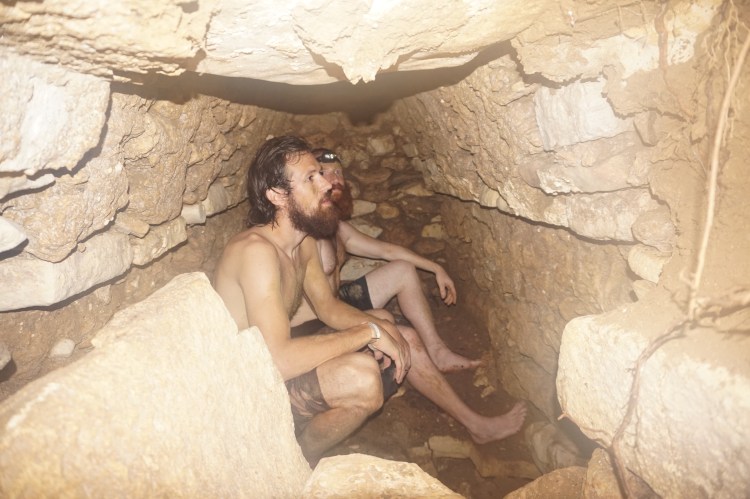
Once we were dropped off, we started walking down the road that lead to Bajlum Pakal. This road was a dead end with a small Ejido called Nueva Betania half way along it. Once we made it to the village, rather than just ogling us like everyone else, one guy decided to ask where we were heading. We told him where we were headed and he told us there was no services there anymore. We decided not to trust him or at least check to see if we could still put a tent up and find the waterfall ourselves. We walked further and came to a junction in the road, that wasn’t familiar from our look on google the previous night, and there wasn’t a sign post in sight. Luckily a car drove past and told us where Bajlum Paakal was, and then told us that it had been closed for a couple of years. Seeing as we were 6km in, we decided to take a look anyway and he was correct. It was still there, but it was being reclaimed by the jungle. There was a motorbike there so we called out and a man came to greet us. He told us it was closed and that the only people who came here were people who would cut down trees to steal wood. I think this is what he was doing. We had a look around but it was starting to get a little bit later on in the day so we decided not to risk staying on the land without permission, with thieves around us, and head back to Neuva Betania.
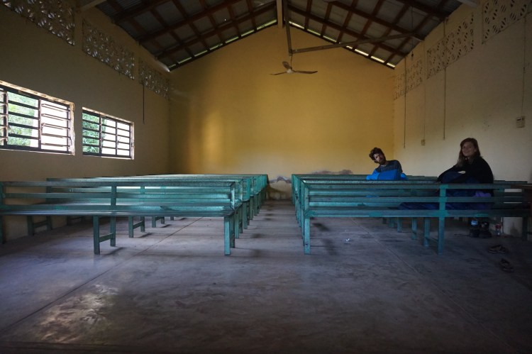
We found the Chief of the Ejido (I can’t remember or spell the Spanish word for it) and asked him if there was anywhere to stay in his village. There were no hotels, restaurants or anything of that sort, it was a small Ejido of just a couple hundred people. He said we could stay in their re-union hall with a guy who was working on the roads here. This was like a town hall with rows of metallic benches where the whole village would come for meetings and stuff. We made a couple of beds and went to the local shop to get some grub. Dinner that night was Tostada’s (fried tortillas) with tinned ham, tinned frijoles and tinned jalapeños on top. It is probably the least appetising thing I had eaten since I ate dog food many years back.
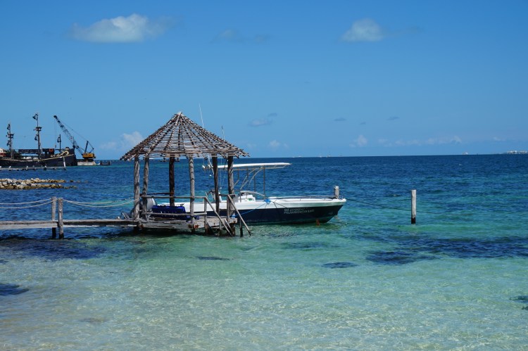
We re-evaluated our plans because, obviously, our map was out of date and we were about to walk into a remote part of Mexico. We decided to go to a place called Tres Lagunas, at the end of our planned walk, use their internet and leave anything there we didn’t need to carry with us. The weight of our bags were too much and fortunately, Pablo, the owner at Tres Lagunas was nice enough to let us leave some stuff behind. Tres Lagunas is another Eco-Touristic Centre that has 3 lakes and is a sanctuary for crocodiles. We camped there for one night next to one of the Lakes and the next morning we planned to sort out our bags and set off for our walk.
Neither of us are very good at getting up early and getting ourselves sorted so we decided to stop off at a Vallescondio, where Alex had seen a hotel with cheap rooms so we could get a good feed in and a decent nights kip before we actually set off on our walk. We got out and realised that this was not the place it was supposed to be. It was actually 8km further down the road. We had some coffee and breakfast and walked the 8km to the actual place we wanted to stay, Camino Verde. The food was good and cheap, as was the room and we were finally ready to leave for our walk. We got a collective the next morning and arrived at Crucero Chancala, the start of our week of walking through the Biosphere of Montes Azules.
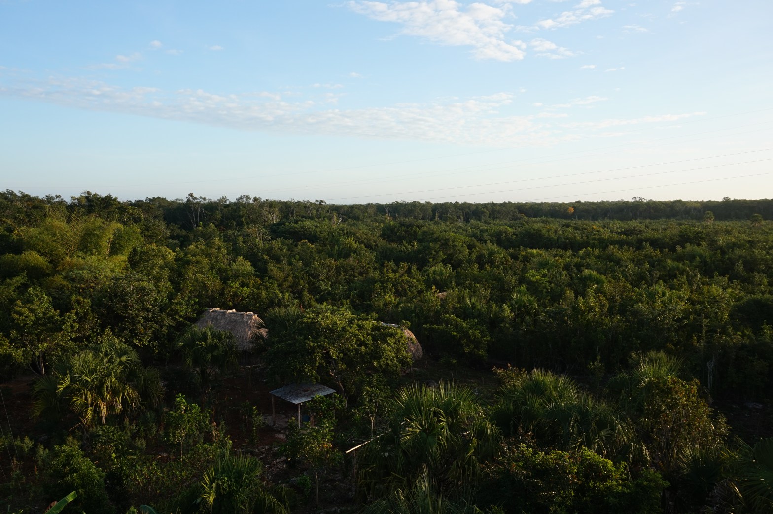
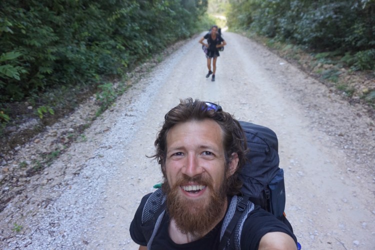
True to form, and our luck, it started to rain as soon as we started walking. We grabbed a poncho each from a little hardware store and set off walking towards the first town, La Reforma. From La Reforma, it was 36.5km to the first planned destination, Metzabok. Metzabok was a mayan village on a large lake that has still kept its traditions and old ways. Google told us that there was 3 villages within the first 13.5km then nothing until El Diamante, which was 29km from La Reforma and 7km from Metzabok. To do the whole journey in one day meant we would be walking in the dark, which is not advised due to the road being used by criminals to traffic wood, people and drugs. We needed to find somewhere to stop off along the journey.
Having started walking in the rain, it continued to do so for much of the day. After 4km of near enough constant uphill walking, we made it to 5 de Mayo, a tiny Ejido along the road. There wasn’t much there other than a lot of kids and people staring at us as we walked through. We continued to walk uphill, in the rain, until we reached the 9.1km mark and a little place called Chocoljaito. It was on the river Chocoljaito so we decided to stop for ‘lunch’ and a little rest by the river. We asked if there was anywhere to get food but it had one shop only that sold snacks and nothing of any nutritional use. After we had rested up, we pursued on and made it to Crucero Peñal, a junction just before El Resbalon which was at the 13.2km mark. This leg of the journey had been dry but as soon as we reached Crucero Peñal, the heavens opened up and we had to take shelter.
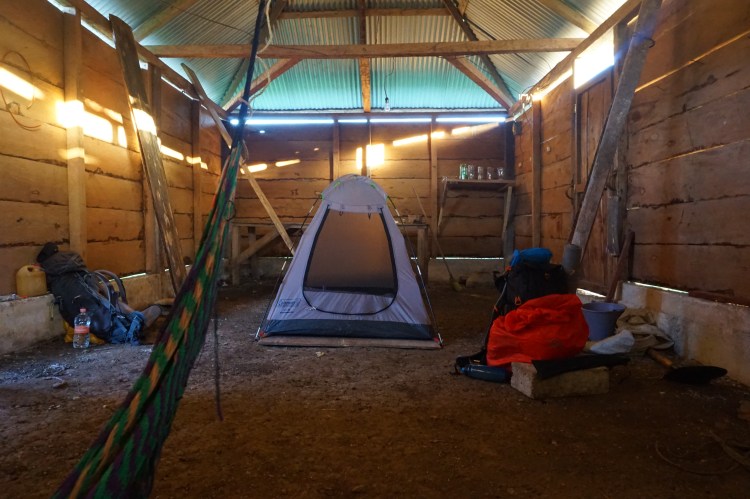
Due to the rapid incline of the walk and the fitness of us both, we deliberated whether we could make it another 16km to El Diamante before it got dark. It was still mid-afternoon but we decided it was safer to stop here if we could, rather than continue on and risk not having anywhere to stay at El Diamante. Alex asked a lady next to the shop if there was anywhere to stay around here. There was no hotels or places to stay but the ladies mum had an empty house and she said she would ask her if we could use it. After a bit, a man called Manuel came and said we could use their empty house. It was basically a barn with a dirt floor and 3 lambs in the garden out back by the toilet. It was right on the junction, which also happened to be where all the taxi drivers were hanging around and also where they would took a leak. For us it was shelter where we could put the tent up and free of charge so we weren’t complaining. We shared the only beer in town and managed to get some reasonable food, cooked at the local (and only) shop. We relaxed for the night and managed to get a decent enough night sleep.
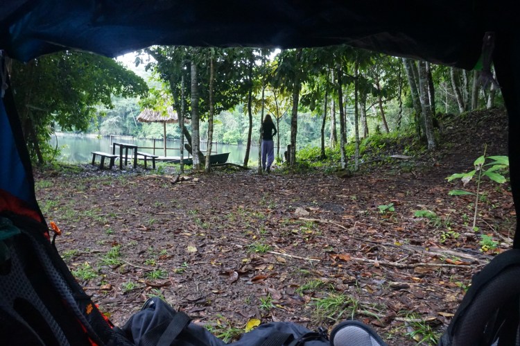
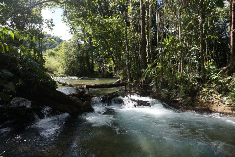
The next morning we set packed up and set off early (for us) with almost 23km ahead of us before we reached Metzabok. It was 16km until the village of El Diamante, according to Google, so we were expecting a lonely walk for a bit. Before long we came to small village called San Miguel which Google seemed to forget off its maps. It was small but it was big enough to be seen by Googles satellites for sure. Just after San Miguel, there was another little village that was slightly bigger than the previous. This too was nowhere to be seen on Google. Just after this village we stumbled across ‘Parador Eco-Touristico – Agua y Campo’, an Eco-Touristic Centre with a river, small waterfalls and a campsite. Had we known about this place, we could have enjoyed the location and camped there for the night, rather than in someone’s barn. Yet again this was not available on big G’s maps, it was not even visible. We stopped off anyway to have a quick swim and enjoy the river before we set off again.
A few km’s further down this remote uninhabited road, we came across another small village called El Piedron. There was the usual scenario of people staring at us and kids running into their gardens and then staring at us. It was like we were on a catwalk or being paraded infront of everyone. Then we heard someone say, “Hello, how are you?” We were both shocked that we had heard some English, it had been a while. We went over and said hello to a young guy on the side of the road, Fredy was his name. We chatted to him for a bit, in English and in Spanish, before he (or Alex) invited us into his home for some food. His mum made us some scrambled eggs and tortillas and he gave us lots of information about the area and the road ahead. Apparently, Google didn’t show these places on their maps because huge corporations were trying to buy the land, evict the people and cut all the trees down and use the land to make some money. Therefore, these places didn’t need to exist on the internet, then people would not notice that they were gone. He also told us that there was a lot more uphill walking to do and that the next few villages weren’t as friendly as the previous ones.
We set of with full bellies and started the slow long incline. The next village we would come across would be El Diamante. With the time we had wasted at the river and eating at Fredy’s, we needed to push on and try not to stop that much anymore. Luckily Fredy was right, El Diamante wasn’t as hospitable as the previous places, so there was no reason to stop. People still stared at us, but not with the same bemused look, it was more of an unwelcoming stare. We quickly walked through El Diamante, avoiding eye contact with the drunk dude in the road and walked the next 3km to Peña Limonar. The reception was pretty much the same here as we received in El Diamante so we walked straight through knowing that we had about an hour left of walking.
There was supposed to be a turning about 10 minutes after Peña Limonar which would lead us 4km up the road to Metzabok. This turning never arrived. Instead we were greeted with one of the steepest inclines we had come across yet, and it went on for ever. We were under the impression that we had somehow missed the turning or gone the wrong way. We even came across another unmapped village, Cuauhtemoc, which fortunately had friendlier people that told us we were on the right road, even if Metzabok was still a long way away.
We were starting to struggle with the distance we had covered and the lack of energy remaining. Finally the turning for Metzabok had arrived but there were no clear sign posts again. It was definitely the right turning but there was a feeling that it might not exist anymore. We met a guy at the junction and he informed us that there was a community, Laguna Colorada, at the end of this 4km road but Metzabok was much further along the road we were already walking.
We walked a further 5km past this junction and through another little village called Neuva Esperanza. Everyone in this village told us to take the left at the next crucero, after Neuva Esperanza, and they all gave varying times and distances ranging from 15 minutes to 2 hours. When we eventually made it to this junction, there was a familiar lack of sign posts. We waited around for some signs of life to help us know if we had to go down this road or not. Eventually a young dude called Felipe turned up on a motorbike. He let us know that it was the turning for Metzabok but it was a good 2-3 hour walk more with half an hour of sunlight left and no village close by. This was where the conversation in Spanish went above my level and the next thing I knew, we were getting onto the back of his motorbike, backpacks and all. It was a bit of a tight squeeze but we managed to get us all on, even if I was sat on the metal rack at the back of the bike.
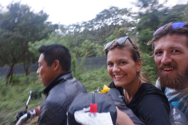
The next 20-25 minutes was fun but one of the sketchiest things I had done in a while. The roads are made up of loose rocks and gravel and have crevices and pot holes all over. To make it worse, the road was constantly going uphill and downhill. The uphill parts left me hanging on for my life with the weight of my backpack pulling me off the bike. The downhill parts were terrifying as it was impossible to use the brakes without skidding and the bike was picking up speed and bouncing all over the road. We made it to Metzabok in one piece and were dropped off at the ladies house who ran the Eco-Touristic centre in Metzabok.
I know we cheated at the end, but not including the 6.2km motorbike ride, we had walked nearly 30km that day and just over 40km over the last 2 days. We had made it to our first destination, and were in need of some well-deserved rest. The walk itself was challenging but thoroughly worthwhile with interesting people and breath-taking views along the way.
This part of the blog was almost as long as the walk so I will continue the journey in the next post.
")